

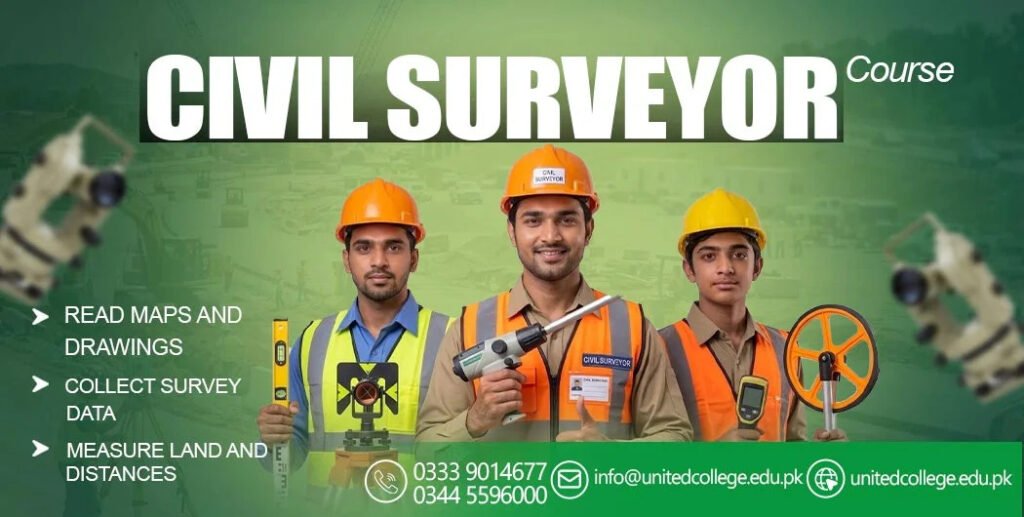

A road may look simple when you drive on it, but building a safe and durable road requires careful planning, accurate measurements, and proper construction control. Before heavy machinery starts working, the construction team needs to know exactly where the road should be built, how high or low different areas are, and whether the design matches the actual ground conditions.
This is where a Civil Surveyor becomes an important part of the road construction team. Surveyors collect accurate information about the land and provide measurements that help engineers, contractors, and site workers make correct decisions throughout the project.
Why Surveying Matters Before Road Construction Begins
Every road construction project starts with understanding the existing land. The ground may have slopes, uneven surfaces, drainage problems, buildings, utility lines, or other obstacles that can affect construction.
A Civil Surveyor examines the site and collects important measurements before construction begins. These measurements help the engineering team understand the existing terrain and compare it with the proposed road design.
Accurate surveying at this stage can help reduce construction errors. If the original measurements are incorrect, problems can appear later when the road levels, drainage systems, or alignment do not match the approved design.
Setting Out the Road Alignment
One of the major responsibilities of a Civil Surveyor is helping establish the correct road alignment. Road alignment determines the horizontal position and direction of the road.
Using the approved drawings and survey data, the surveyor transfers important points from the design onto the actual construction site. These points guide workers and machinery during excavation, grading, and other construction activities.
Correct alignment is important because even a small positioning error can affect road width, curves, intersections, drainage, and connections with existing roads.
Measuring Ground Levels and Elevations
Road construction depends heavily on accurate levels. The existing ground may not have the required elevation for the proposed road, so contractors need reliable information before excavation and filling work begins.
A Civil Surveyor measures existing ground levels and determines important elevation points across the site. This information helps the engineering team understand where soil needs to be removed and where additional material may be required.
Level measurements are also useful when establishing the formation level and other important layers of the road structure.
Supporting Earthwork and Excavation
Earthwork can represent a major part of road construction. Large quantities of soil may need to be excavated, moved, compacted, or placed in low areas.
During this stage, the Civil Surveyor checks whether excavation and filling are being carried out according to the required levels and dimensions. Regular measurements help the site team identify areas where work needs adjustment.
This process can also help contractors avoid unnecessary excavation or filling. Better control of earthwork can contribute to efficient use of construction materials and equipment.
Controlling Road Width and Cross Sections
A road is not only defined by its centerline. It also has a specific width, slope, shoulder arrangement, and cross-sectional profile.
The Civil Surveyor helps establish and check these dimensions during construction. Cross-section measurements can show whether the road is being constructed according to the approved design.
For example, the surveyor may check the distance between the road centerline and edges, the elevation of different points, and the required slope across the road surface.
Checking Drainage Levels
Water management is one of the most important considerations in road construction. Poor drainage can allow water to collect on or around the road, potentially affecting the pavement and surrounding ground.
A Civil Surveyor provides accurate levels for drainage channels, culverts, pipes, and other drainage structures. These measurements help ensure that water can move according to the drainage design.
Correct levels are particularly important where drainage structures connect with existing systems. A small level difference can affect how effectively water flows through the system.
Using Modern Surveying Technology
Modern road projects often use advanced surveying equipment and digital methods. Total stations, GPS or GNSS equipment, digital levels, drones, and surveying software can help collect and process site information.
A skilled Civil Surveyor needs to understand how these technologies work and how to use their results correctly. Digital tools can make it easier to collect large amounts of information and compare actual site conditions with the project design.
Technology does not remove the need for professional judgment. Survey data still needs to be checked, interpreted, and used correctly by trained professionals.
Monitoring Construction Progress
Surveying does not stop after the road alignment has been established. Measurements are required throughout different stages of construction.
The Civil Surveyor may return to the site to check completed work and compare it with the required drawings and specifications. These checks can cover road levels, alignment, widths, slopes, drainage structures, and other construction elements.
Regular monitoring helps identify errors while they can still be corrected. This can be more efficient than discovering a major problem after several construction stages have already been completed.
Working With Engineers and Contractors
Road construction involves several professionals working together. Engineers prepare designs and technical requirements, contractors manage construction activities, and workers carry out physical work on site.
The Civil Surveyor connects many of these activities through accurate site measurements. Survey information helps engineers understand actual site conditions while giving contractors clear points and levels to follow.
Good communication is therefore an important part of surveying work. The surveyor needs to understand drawings, communicate measurements clearly, and report issues when site conditions differ from the design.
Why Accuracy Is So Important in Road Projects
Road construction involves many connected elements. If one part is positioned incorrectly, it can create problems for another part of the project.
For example, an incorrect road level could affect drainage. Incorrect alignment could affect road width or connections with intersections. Poor elevation control could also create additional earthwork requirements.
The work of a Civil Surveyor helps reduce these risks by providing accurate measurements and regular construction checks. Surveying therefore supports quality control from the early stages of a road project through to completion.
Skills Needed for Road Construction Surveying
A successful surveyor needs more than the ability to operate surveying equipment. Knowledge of construction drawings, coordinate systems, levels, measurements, and site procedures is also important.
A Civil Surveyor should have strong attention to detail because small measurement errors can have a significant effect on construction work. Basic mathematics, communication skills, technical knowledge, and the ability to work with digital surveying tools are also useful.
Practical training can help beginners understand how surveying concepts are applied on real construction sites. Learning through practical exercises can make it easier to understand measurements, setting out, levels, and site documentation.
What Happens When Surveying Is Not Done Properly?
Poor surveying can create expensive problems during road construction. Incorrect measurements may result in misplaced structures, unsuitable road levels, incorrect slopes, or unnecessary earthwork.
Some errors may be discovered quickly, while others may remain hidden until later stages of construction. Correcting them can require additional labor, materials, equipment, and time.
For this reason, professional surveying is an important part of construction quality control. Accurate information at the right time helps the project team make better technical decisions.
How a Civil Surveyor Supports the Final Construction Stages
As road construction moves toward completion, surveying continues to play an important role. The survey team may check finished levels, alignment, dimensions, drainage features, and other elements against the approved requirements.
The Civil Surveyor can also assist with recording final measurements and preparing information needed for project documentation. These records may be useful for checking completed work and maintaining accurate project information.
A road project requires continuous measurement rather than a single survey at the beginning. This ongoing process helps ensure that construction remains connected to the approved design.
Questions and Answers About Civil Surveyors in Road Construction
What does a Civil Surveyor do in road construction?
A Civil Surveyor measures land, establishes road alignment, checks elevations, sets out construction points, and monitors whether construction work follows the approved design. Their measurements support engineers and contractors throughout the project.
Why is surveying important for road construction?
Surveying provides accurate information about the land and construction work. It helps control alignment, levels, widths, slopes, drainage, and other important features of a road project.
What equipment does a Civil Surveyor use?
A Civil Surveyor may use total stations, digital levels, GPS or GNSS equipment, measuring tools, data collectors, and surveying software. The equipment used depends on the size and requirements of the project.
Does a Civil Surveyor work throughout the entire road project?
Yes. Surveying can be required during site investigation, setting out, earthwork, drainage construction, pavement preparation, and final checking. The exact responsibilities depend on the project and the surveyor’s role.
Can surveying technology improve road construction?
Modern surveying technology can make data collection and site measurement more efficient. GPS, total stations, digital levels, drones, and software can help survey teams collect and manage accurate project information.
What skills should someone learn to become a Civil Surveyor?
A person interested in this career should develop skills in surveying instruments, construction drawings, leveling, measurements, coordinate systems, basic mathematics, digital surveying tools, and site communication. Practical training can also help build confidence in real construction situations.