


Land development isn’t just about clearing space and starting construction. The success of any residential, commercial, agricultural, or industrial project often depends on something that isn’t immediately visible—water. Understanding how water moves across and beneath a site can prevent expensive mistakes later. That’s where a Hydrological Survey becomes valuable.
Whether you’re planning a housing project, managing farmland, or developing infrastructure, a proper hydrological assessment helps you make informed decisions. It provides insights into surface water, groundwater, drainage patterns, and flood risks before any major work begins.
In many cases, spending time on a survey at the beginning can save significant costs in repairs, redesigns, or environmental compliance later.
What Is a Hydrological Survey?
A Hydrological Survey is a detailed study that examines how water behaves within a specific area. The survey evaluates both surface water and groundwater conditions to understand water availability, movement, storage, and drainage.
Professionals collect information through field observations, topographical mapping, rainfall records, soil analysis, water level measurements, and drainage assessments. Modern surveys may also use GPS technology, GIS mapping, satellite imagery, and digital modelling to improve accuracy.
The goal isn’t simply to locate water. It’s to understand how water interacts with the land throughout different seasons and weather conditions.
Why Is a Hydrological Survey Important?
Many construction and land development problems begin because water wasn’t properly considered during planning.
For example, a site that appears dry during summer could experience severe waterlogging during the rainy season. Likewise, poor drainage planning can increase soil erosion or even affect the structural stability of buildings.
A hydrological survey helps identify these challenges before they become costly issues.
Some key advantages include:
- Better drainage planning
- Reduced flood risk
- Improved groundwater management
- More efficient irrigation planning
- Stronger environmental compliance
- Safer infrastructure design
- Long-term sustainability
Instead of reacting to problems later, developers can design around them from the start.
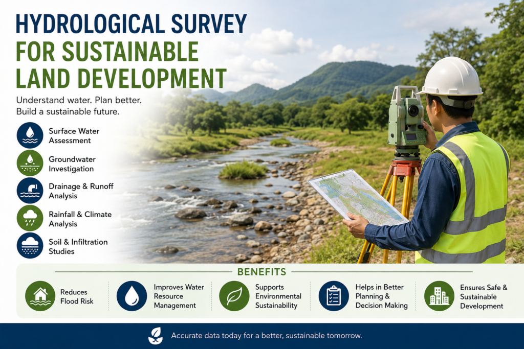
Key Components of a Hydrological Survey
Every project has different requirements, but most surveys include several essential assessments.
Surface Water Analysis
This examines rivers, lakes, streams, ponds, canals, and seasonal water flow across the site. Understanding these patterns helps engineers design proper drainage systems and avoid water accumulation.
Groundwater Assessment
Groundwater levels vary depending on location, rainfall, geology, and seasonal conditions.
Studying groundwater helps determine:
- Water table depth
- Recharge zones
- Aquifer conditions
- Groundwater availability
- Seasonal fluctuations
This information is particularly useful for water supply planning and borewell development.
Drainage Evaluation
Natural drainage paths are mapped to understand how rainwater leaves the property.
Poor drainage often causes:
- Soil erosion
- Foundation damage
- Standing water
- Crop loss
- Road deterioration
Proper drainage design starts with accurate hydrological data.
Rainfall and Climate Analysis
Historical rainfall records help estimate future water flow patterns.
Engineers use this information when designing:
- Stormwater systems
- Retention ponds
- Culverts
- Flood protection structures
Ignoring rainfall trends can result in undersized drainage systems that fail during heavy storms.
Soil and Infiltration Study
Different soils absorb water at different rates.
Clay soils tend to retain water, while sandy soils allow faster infiltration.
Knowing these characteristics helps determine:
- Water retention
- Runoff rates
- Recharge potential
- Foundation suitability
Applications of Hydrological Surveys
A Hydrological Survey supports a wide range of industries and projects.
Residential Developments
Builders use hydrological information to plan drainage, protect foundations, and minimise future flooding risks.
Commercial Projects
Shopping centres, office complexes, warehouses, and industrial facilities require reliable stormwater management systems.
A survey provides the data needed for proper site planning.
Agricultural Land
Farmers benefit from understanding groundwater availability, irrigation potential, and natural drainage patterns.
Efficient water management can improve crop productivity while reducing water waste.
Infrastructure Projects
Roads, bridges, railways, airports, and public utilities all rely on hydrological studies to ensure long-term durability.
Water-related failures can lead to expensive maintenance if these factors are overlooked.
Environmental Conservation
Hydrological studies help protect wetlands, rivers, and natural ecosystems by supporting responsible development practices.
How a Hydrological Survey Supports Sustainable Development
Sustainability isn’t just about protecting the environment. It also means creating projects that remain safe, functional, and efficient for decades.
Water plays a major role in that goal.
A hydrological survey helps developers:
- Preserve natural drainage systems
- Reduce erosion
- Improve groundwater recharge
- Lower flood risks
- Protect nearby ecosystems
- Plan responsible water usage
Small planning decisions made today can have long-lasting effects on both communities and natural resources.
Common Challenges Without a Hydrological Survey
Skipping a survey may appear to save time initially, but it often creates larger problems later.
Some common issues include:
- Flooded construction sites
- Unexpected groundwater levels
- Basement water seepage
- Foundation settlement
- Poor irrigation planning
- Drainage failures
- Regulatory delays
- Increased maintenance costs
These problems are frequently more expensive to fix than conducting a proper survey before construction begins.
Technologies Used in Modern Hydrological Surveys
Today’s hydrological investigations are far more advanced than traditional manual inspections.
Professionals commonly use:
-
- GPS surveying equipment
- Geographic Information Systems (GIS)
- Remote sensing
- Satellite imagery
- Digital elevation models
- Drone mapping
- Water level monitoring equipment
These technologies improve accuracy while reducing survey time.
Choosing the Right Hydrological Survey Provider
Not every survey offers the same level of detail.
When selecting a consultant or survey team, consider:
- Experience with similar projects
- Modern survey equipment
- Knowledge of local geology
- Clear reporting methods
- Environmental expertise
- Regulatory understanding
A detailed report should present practical recommendations rather than just raw data.
Best Practices After Completing a Hydrological Survey
A survey should guide future decisions rather than sit unused in project files.
Property owners and developers should:
- Follow drainage recommendations
- Monitor groundwater conditions regularly
- Protect natural water channels
- Review flood mitigation measures
- Update assessments if land use changes significantly
Using survey findings throughout the project lifecycle leads to better long-term results.
Final Thoughts
A Hydrological Survey provides valuable information that supports smarter land development. From understanding groundwater conditions to managing drainage and reducing flood risks, it forms an important foundation for responsible planning.
Whether the project involves agriculture, residential construction, commercial development, or public infrastructure, investing in reliable hydrological data helps minimise uncertainty and improve long-term sustainability.
As land development continues to grow, informed water management is no longer optional. It’s a practical step toward building projects that are safer, more efficient, and better prepared for future environmental challenges.
Frequently Asked Questions (FAQs)
1. What is the purpose of a Hydrological Survey?
A Hydrological Survey evaluates surface water and groundwater conditions to support land development, water management, drainage planning, and environmental protection.
2. When should a Hydrological Survey be conducted?
It is best carried out before construction, land acquisition, agricultural development, infrastructure planning, or any project that may affect local water resources.
3. Who needs a Hydrological Survey?
Developers, engineers, architects, farmers, government agencies, industrial planners, and property owners can all benefit from hydrological surveys.
4. How long does a Hydrological Survey take?
The duration depends on the project’s size, location, terrain, and data requirements. Smaller sites may take a few days, while larger developments can require several weeks.
5. Can a Hydrological Survey help reduce flood risks?
Yes. By analysing drainage patterns, rainfall, topography, and water flow, a hydrological survey helps identify flood-prone areas and supports effective flood mitigation planning.